Portfolio Details
- Home
- Portfolio Details
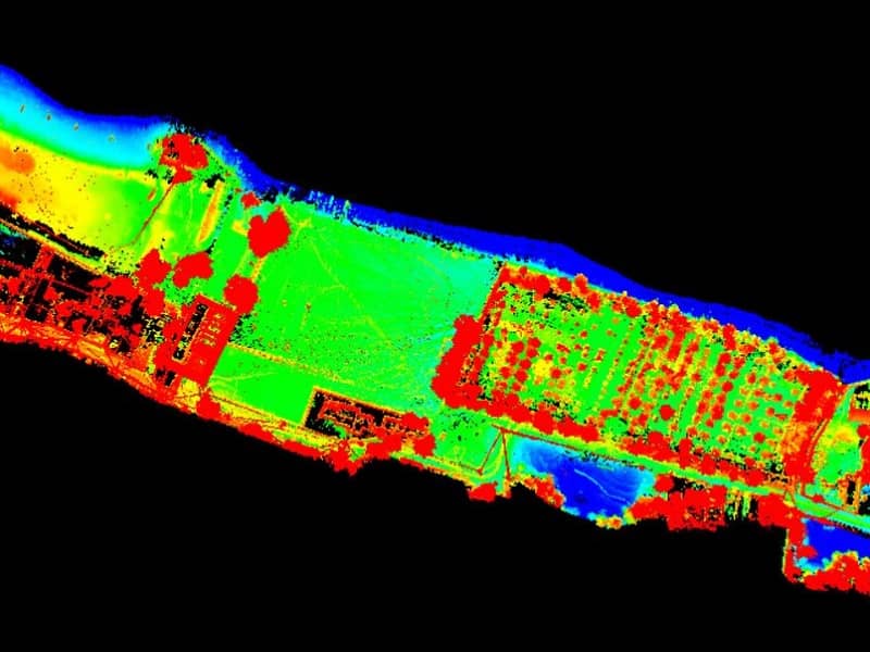
Corridor Mapping (approx. 31 k.m) Aerial & Hydrographic Survey of
Buriganga Riverfront from Mandail to Baluchar at Keraniganj
- Category: Aerial Survey, Hydrography, LiDAR Survey, Attribute Geodatabase
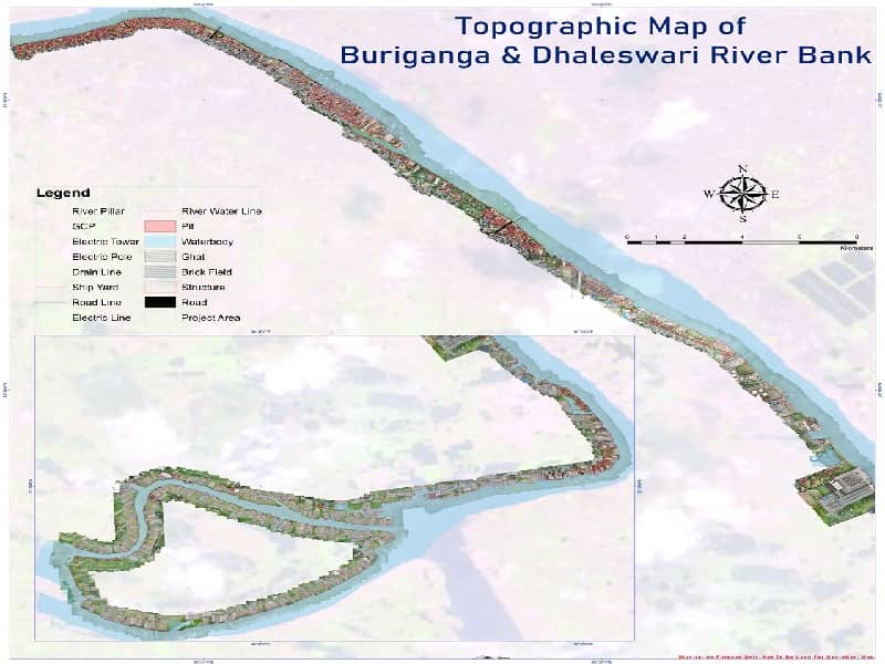
- Project objective: Conceptual Integrated Riverfront
Development and Bank Protection System of Buriganga River from Zinzira Ferry Ghat to
Dhaleshwari River near Brahmangachha at Keraniganj, Dhaka."
- 2360 Acres Land Area
- 33 km Bank Corridor
- 10166 Building Feature
- 5160 Drone Image
- 30 Cadastral Survey Map
- 26 3D GCP
- Drone+ RTK+ LiDAR+ Sonar+GPS+ Satellite Image+ Army Service Map Combined
- Client: Vitti Sthapati Brindo Ltd, Bangladesh
- Project date: 18 August, 2020