We use the latest geospatial technology to collect positional data for our client’s assets. Whether for electricity networks, roads, railway, or for large area survey, LiDAR provides an effective method to survey both the natural and man-made environment.
LiDAR (Light Detection and Ranging) provides accurate 3D data. LiDAR mapping can be in the form of Aerial LiDAR Survey, Terrestrial LiDAR or Mobile LiDAR scanning using vehicle mounted devices. All options have advantages but the best method simply depends on the specific aims of a given project.
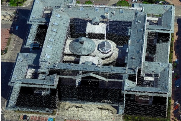
Laser scanning can be utilised to capture significant urban areas in a timely and efficient manner. For the majority of applications as like building or plant, as-built data it needs for facility updates, expansions, renovation solutions and overall management for the life of a building/ structures terrestrial scanning (Tripod mounted) is the best methodology.
For larger or inaccessible areas such as major roads or brownfield sites Mobile scanning (vehicle mounted) or Ariel scanning (UAV) can be organised.
Airborne Laser scanning
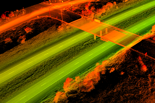
The advantage of airborne laser scanning is that you can get very good documentation of the terrain even in areas with a lot of vegetation. This allows the method to calculate a terrain surface with substantially greater accuracy and reliability than with other techniques. The point cloud is further processed by separating different objects such as terrain surface, vegetation, buildings, power lines etc.
We operate different LiDAR sensors installed in the aircraft, they register millions of ground points with frequencies up to 400kHz and 1000kHz ! They are fitted with an Inertial Measurement Unit (IMU) and a flight management system . Accuracy can reach +/- 2 to 20cm. The main advantage is quick acquisition: it's possible to acquire 1,000 square kilometers within 2 days of flight.
UAV Laser scanning
Our UAV LiDAR System collect three-dimensional points simultaneously with the aerial photos, giving each individual point an RGB color value as well as a ground / no-ground classification. Airborne LiDAR units can penetrate tree foliage and can receive points where aerial camera cant penetrate. Later points to be classified as bare earth, high or low vegetation, building, and so on including RGB mode.
We’re experienced in a wide range of data processing software systems, and we can provide your LiDAR data in your preferred format. Many clients use our mobile survey and mapping data to support Digital Terrain Models with a georeferenced point-cloud dataset After post processing, further feature extraction of the 3d point cloud data. Mapping output in desired format like: ‘Autocad *.dwg’ or ‘ArcGIS *.shp’ files can be obtained
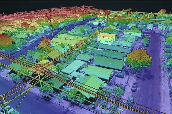
Mobile Mapping System
Capturing up to a million or more survey-quality points per second, our mobile LiDAR solutions move your project forward far faster than conventional surveying techniques. Our team members use the most advanced laser scanning tools to save you time and money. We equip our mobile LiDAR platform with 360-degree LiDAR sensors, high-resolution cameras, GPS receivers, and an Inertial Measuring Unit to capture the industry’s highest data density. This non-invasive surveying method accurately locates features inaccessible by other methods. If daylight site access is constrained data collection can even be performed at night.
Asbuilt Survey
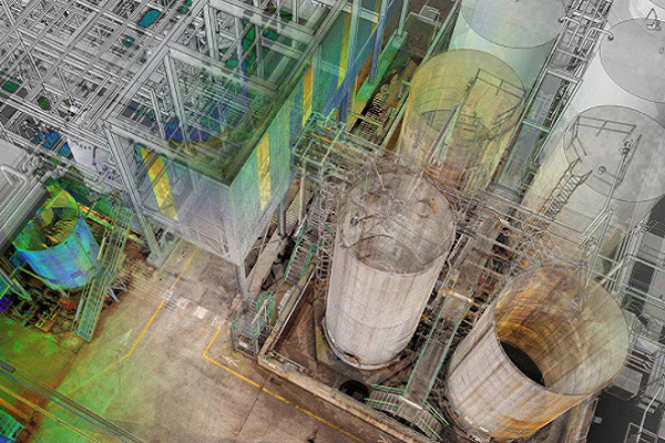
As buildings become more complex, engineers, builders and owners increasingly rely on as-built design plans to ensure the accuracy of renovation plans and ongoing facility management. Data and models that accurately reflect existing structures, our reliable as built 3D scanning we capture the accurate as-built data for facility updates, expansions, renovation solutions and overall management for the life of a building. 2D floor plans, sections and elevations can be extracted and tailored specifically to the client’s specification. 3D CAD Models can be specified. These can be produced in wireframe, surface or solid format and typically delivered in DGN or DWG format.
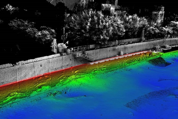
Bathymetry Laser Scanning
We gathers laser data both on land and in water, using airborne laser scanning; well suited for surveying shallow waters and land areas with high accuracy and precision. When collecting depth data in shallow coastal sea areas along the beach zone, the data will contribute to a comprehensive terrain model that binds traditional topographic data together with sonar data collected from boat-based systems. The data collected is compiled and usually delivered to a customer as a terrain model or elevation contours, possibly also with orthophoto as an additional product. Such a solution appears to be perfect in the context of executing projects consisting in scanning of wetlands and floodlands, monitoring of coastlines, as well as analysing watercourses and waterways.