Today technology is rapidly evolving, but there are still some gaps where modern machine cant work , as drone imaging, satellites and GPS cannot work under tree canopy, LiDAR is too costly. Here comes total station. The field data is gathered utilizing Electronic Laser/Infrared Total Station capable of measuring distances to +/- 1mm (1/24”) accuracy.
Total station can be tripod mounted or attached to structural elements within the facility in many configurations allowing easy movement through even the most congested of areas without loss of accuracy. In addition to the information gathered via the Total Station, we georeference and merge Total Station data using our RTK GPS units.
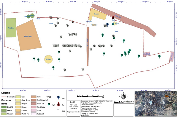
Topographic Survey
Topographical survey or land survey is a detailed accurate plan drawing identifying both natural and manmade features within a specified area. The plan shows all features such as buildings, boundaries, services covers and site levels. Details on information on site is based on client specification. Normally presented digitally in GIS/CAD format, The final topographical survey drawings will be provided in either 2D or 3D file formats (DWG, DXF, SHP). We are also able to provide scaled paper copies.
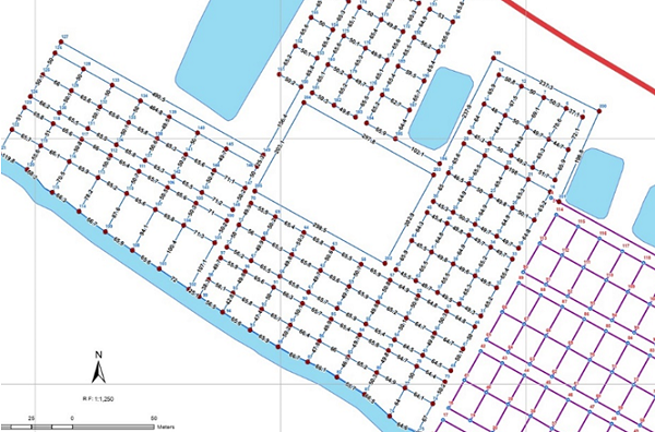
Layout Survey/ Site Layout Staking
Before breaking ground on a project, staking out the location of proposed structures or improvements on a property is essential. Our land surveyors can perform construction staking and site layout to interpret construction plans and mark out reference points prior to starting project. Our experience surveyor can mark & Stak land area or proposed plan on real earth with precision accuracy.
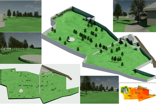
As-Built/ Design Survey
The purpose of the As-Built Survey – also commonly called a Physical Survey – is to show the property “as it is built” at a particular point in time. While a pre-construction survey is performed to document conditions prior to construction work being performed, the As-Built survey is conducted to show the current state of the site at various stages throughout the duration of a project. As-Built 2D & 3D Surveys of all sorts of Structures including Buildings, Bridges, Floors, Roads, Towers, Pylons, etc.
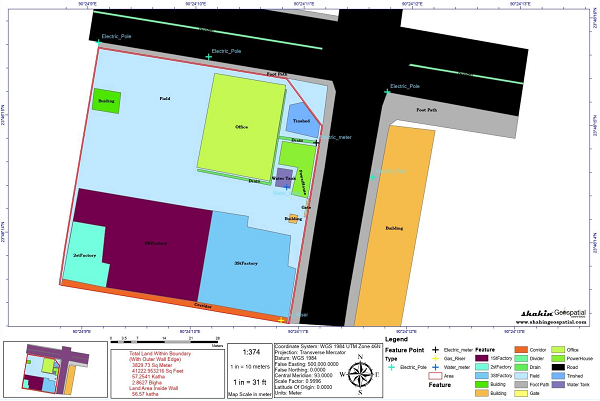
Boundary Survey
We understand that new or ongoing boundary disputes can sometimes cause distress and upset for individuals involved and we work towards resolving things smoothly and quickly. We provide precision and accurate measurements, mapping and drawing provision to establish or clarify the position of a boundary in order to dissolve potential disputes or provide a standing from which to work from with ongoing or unresolved disputes.
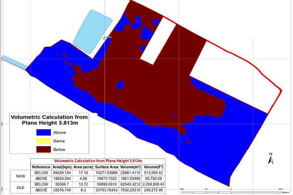
Volume Calcualtion/ Cut-Fill survey
Surveying create detailed volume calculations utilizing data from many sources. We model this data to provide detailed volume calculations for cut and fill exercises, bulk earth movement, contract disputes or cost analysis.