About Us
Shahin Geospatial offers fully integrated global mapping services. Through our combination of equipment’s & geospatial analysts we deliver critical projects – on-time and on-budget. We provide one stop service solutions spanning geospatial data collection, processing, analysis & sharing.
We are experts for combination of variable acquisition components into single projects. Everything is carried out in-house, from the initial project enquiry through to the final hand over of the survey report, without any need to outsource. This includes project preparation, data acquisition, processing and reporting, allowing us to ensure that our high standards are maintained at all stages.
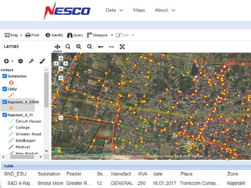
Our data & map service can be shared via state-of the art WebGIS cloud service (Pay as you go), where anyone can edit, store & share data.
Established in 2017 we provide services in all parts of the world through our partner network of companies and technology collaborators.
We approached both by conventional technologies (total stations, GPS), and with the help of digital sensors, fruits of the latest developments (cameras, lidars, bathymetric etc.), in terrestrial mode (cars, trains , boats, pedestrians) or air (planes, helicopters, drones) by static or dynamic measurements.We usually works on following basis
We help our client to design a project, no matter of complexity & scope of services, we ususlaly do acquistion services, if our clients have the sufficient quipments we can process, anlyze and share data If required by our clients we also can send expert personal globally.
ONE SURVEY,
ONE HUNDRED SOLUTIONS.
PROJECTS
MEMBERS
YEARS
COUNTRIES
Core Features
Services
Category of Services Provided by Shahin Geospatial
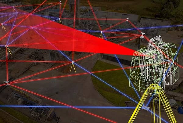
Remote Sensing / Spatial Data Acquisition
Our geospatial data acqusition is completely based on advanced remote sensing techniques. We own RTK for Positional accuracy, Mobile LiDARs, RGB-LiDAR, Integrated UAV & SONAR equipped USV. We collect Geomagnetic, Airborne LiDAR-Photgammetry & satellite imagery via our partner organization
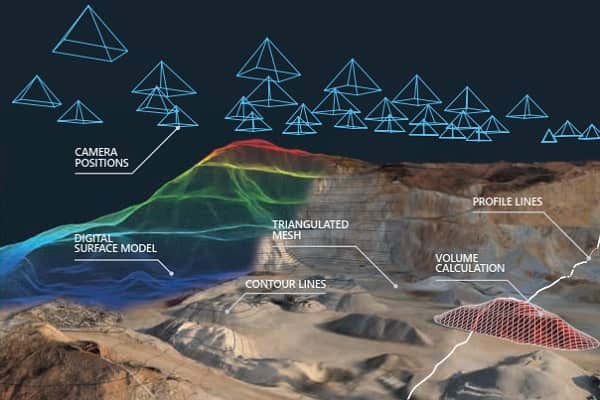
Spatial Data Processing
We Import raw data from RTK-LIDAR-Drone-Sonar-Aircraft-Satellite-GPR and recreate natural environments in digital form. Our survey-grade deliverables which includes processed precise point clouds with automated classification. Produce high-res orthophotos, realistic surface/ terrain models, hand drawn feature extraction, spatial measurements, and more.
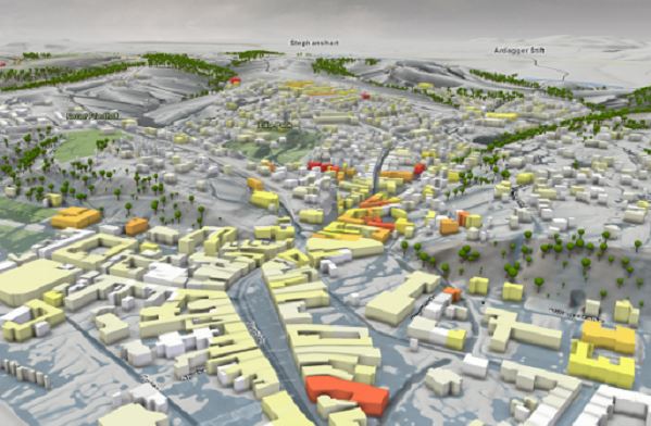
Geosptial Data Analysis
We gather, manipulates and displays GIS data. We create geographic models from imagery, dem, shapefile and data visualizations for more accurate modeling and predictions of trends. Our sanalysis solution varies from drainage modelling to customer profiling. We closely anlyze and predict the consecutive change through our spatial data analysis service
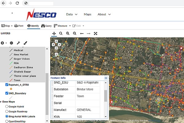
GIS Mapping & Webmapping
We design & publish maps for both individual custom maps and broader mapping solutions to a wide range of Public and Private Sector clients. Our pool of skilled cartographers who know how to incorporate subtle design features to accentuate the look and feel of a map. We also developed WebGIS services where any one can edit, entry and share geospatial data.
Projections & Data Format
Though we can work & deliver the datasets in more than 70 Different formats;but we recommends following due to maintain the uniformity and data interoperablity
Map Projections
To maintain the uniformity and data interoperablity Shahin Geospatial delivers data in GCS WGS 1984 (EPSG 4326) or UTM Coordinate System
Vector Data Format
Our delivered datasets are Standard Shapefile (.shp), Geopackage (.gpkg), Google (.kml/.kmz), AutoCAD (.dwg), & PointCloud (.laz/.sid) format
Raster Data Format
Aerial Orthomosaic, Elevation Models, Satellite Images are provided in GeoTiFF & MrSID.
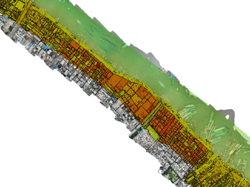
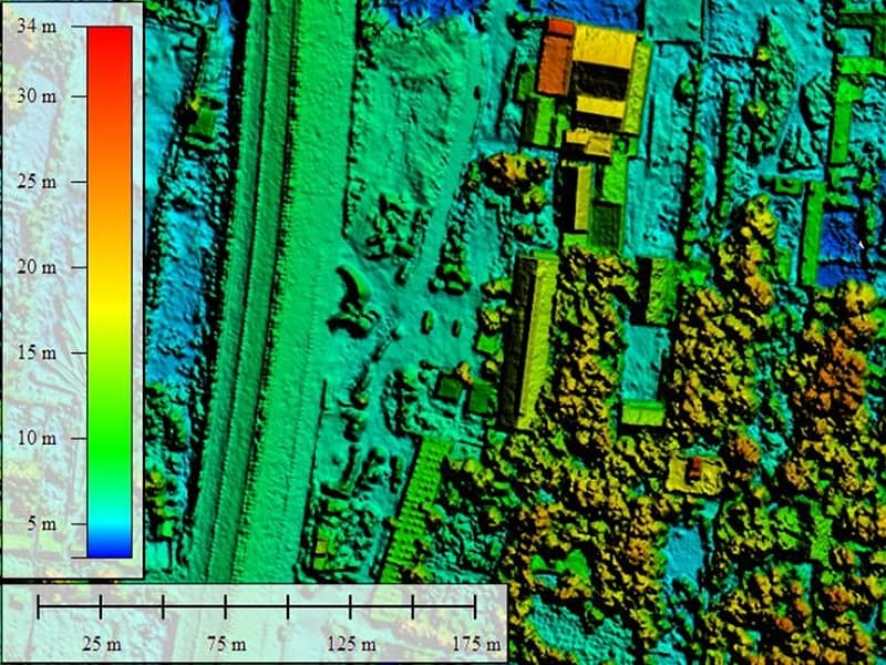
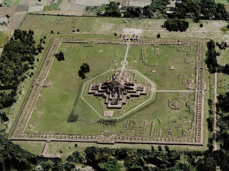
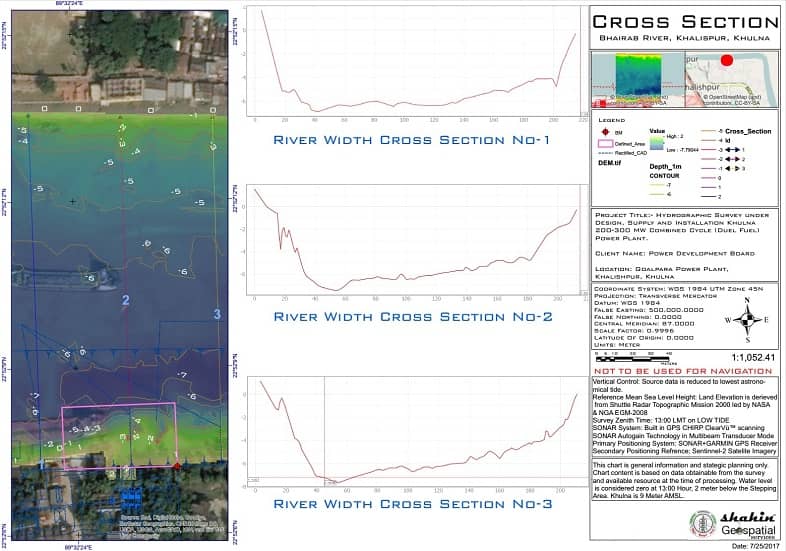
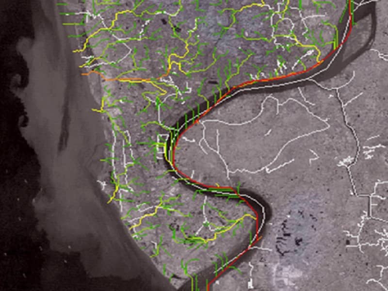
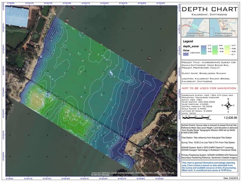
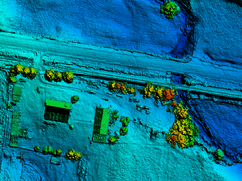
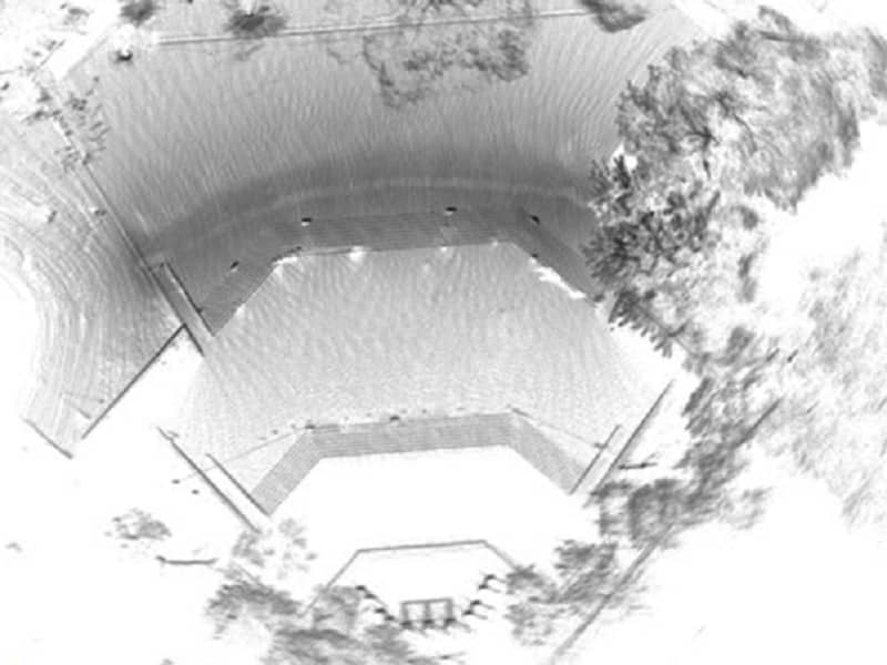
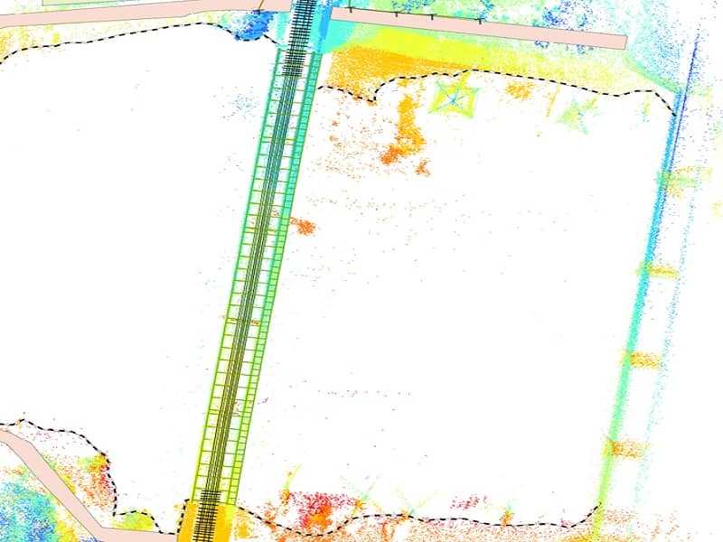
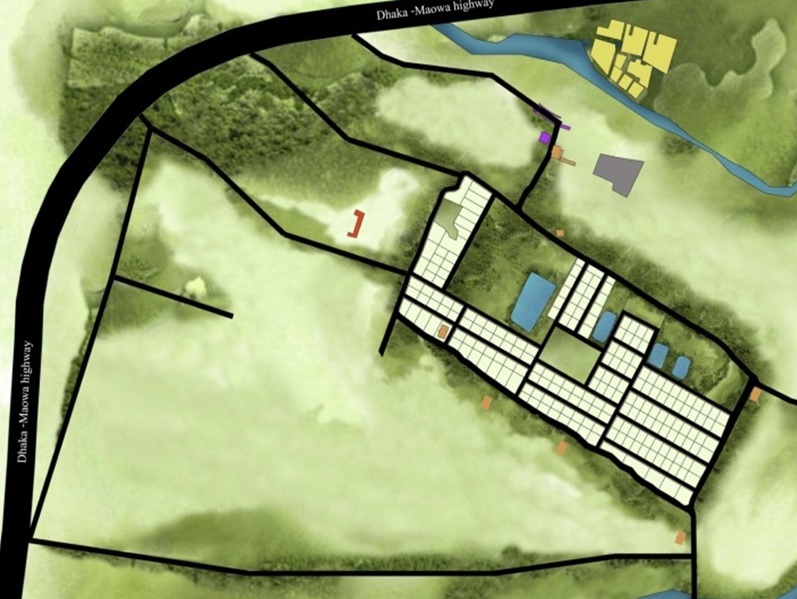
Gallery
Following are portfolio of some of our completed projects

Surveying Equipments
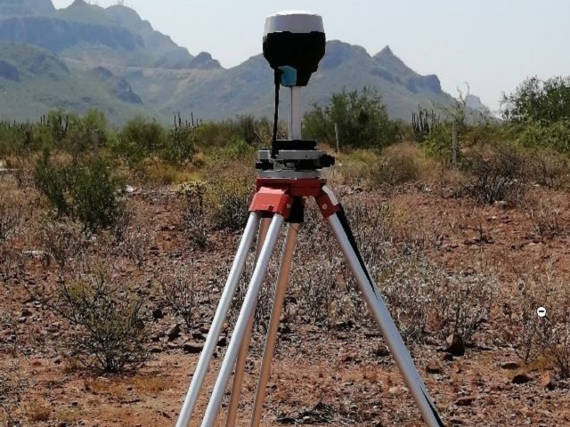
RTK GPS
Centimeter accuracy distances up to 100 km. Supports GPS, GLONASS, BeiDou, Galileo, and QZSS
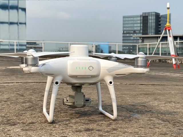
RTK Quad Copter
20MPx, 30min flight time, RTK GNSS
with built in IMU. Range 20KM.
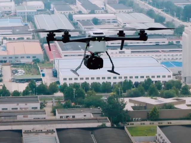
Heavy Lift Quad Copter
MTOW 8KG, Range 20 KM, Endurance 90Min,
RTK Position, LiDAR-Camera Payload
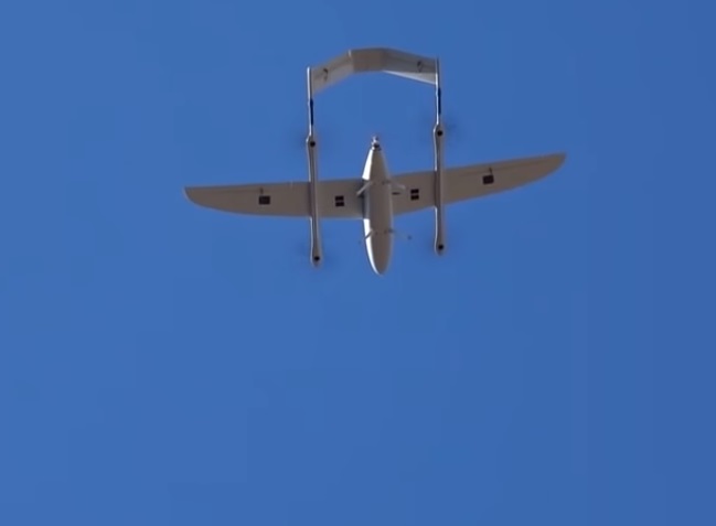
Fixed Wing UAS
MTOW 13KG, Payload 2.1 KG, Endurance 2.5h,
RTK Position, Camera Payload
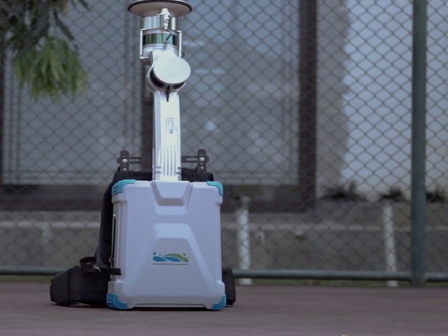
Mobile Mapping System
Indoor- Outdoor SLAM LiDAR, Dual Return
Range 100 Meter, 3,00,000 Points/Sec

Aerial LiDAR (UAS)
Airborne RGB LiDAR, Triple Echo
Range 450 Meter, 3,00,000 Points/Sec
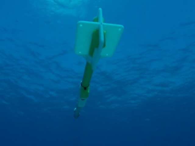
SONAR
200Feet Crystal Image
Depth 3500 Feet, Precision GPS
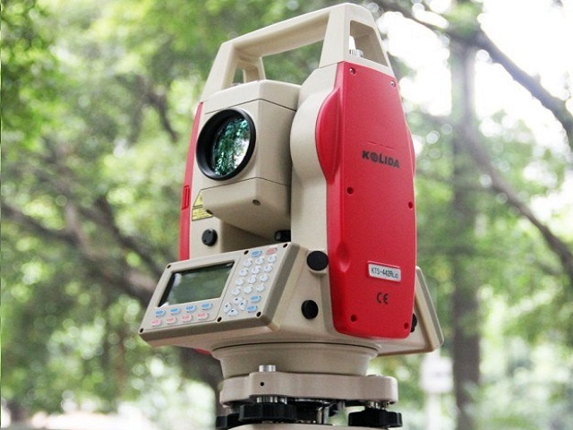
Total Station
800m in reflectorless, 5000m prism range,
with millimeter accuracy
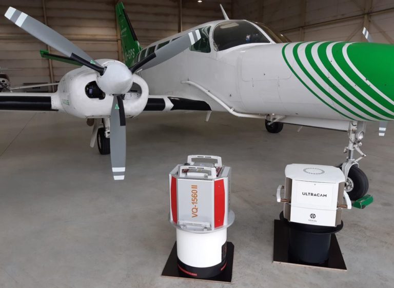
Airborne Systems
(via Partner Network)
Airbone Hybrid Oblique Imaging, Multispectral
Imaging, LiDAR & Geomagnetic Sensor
Clients who trusted us
Customer satisfaction motivates us to provide services of the highest quality and we try to ensure that each of them has good memories of cooperation with Shahin Geospatial. So far, many excellent organizations have trusted us......


Contact Us
Be a Partner
We believe in partnerships.
We believe in long-term relationships that brings value to both businesses. Thats why we open global partnership opportunity. Your contribution lead us to operate advanced geospatial data processing center.
Regarding Details of Partners Network please contact us
+880 1754 291 492 (BD)/ +61 0420 306 501 (Australia)
40 Charlotte Lane, Halifax, Nova Scotia, B3M 4N4, Canada
House-07, Road-1/A, Turag, Dhaka-1230, Bangladesh
Arian Land Survey, 172-176, The Central Coast Highway, Erina, Gosford NSW 2250, Australia